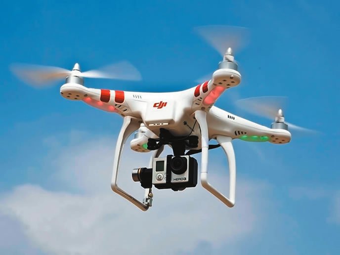
A reader flagged me down in the UAS-dominant Innovations building at AirVenture last month and asked when Aviation Consumer was going to take the lead in protesting the operation of recreational and commercial drones that were on display. This guy was convinced that a midair with that drone over in the corner with the flashing lights and integrated GoPro (pointing to a DJI Phantom quadcopter on display) was going to take him and his Comanche down in the rural Iowa skies. After offering a polite “deal with it, dude—these things aren’t going away,” I pointed him to Mike Glasgow, who was manning the Lockheed Martin Flight Services booth strategically colocated in the UAS exhibition area.

Unlike that paranoid Comanche driver, I’m not exactly losing sleep over swapping paint with one of these things, but on the other hand, it would be helpful to know when and where larger commercial drones are lurking. I might sit up a bit straighter in the seat while transitioning the area. That’s precisely what Lockheed’s emerging Unmanned Aircraft Systems Traffic Management (UTM) service does by utilizing, in part, its web-based Next Generation Briefing product. It’s all about increasing situational awareness, Glasgow told me, when it comes to traditional aircraft coexisting with UAS ops. That’s a tall order, especially given scalability challenges. Glasgow said there are roughly 100 commercial operations currently participating in UTM, but that number is expected to snowball in short order—something that could hinder Lockheed’s ability to better brief pilots on UAS ops, bog down the NOTAM system and increase the workload for telephone briefers. The lack of official policy for smaller amateur-flown UAS vehicles adds to the challenge.

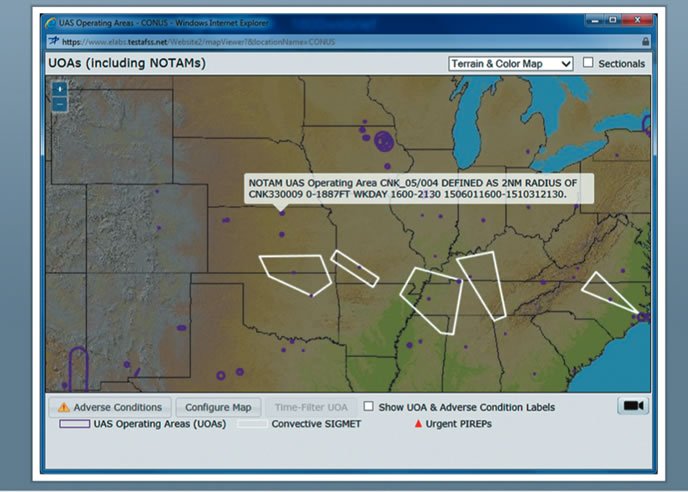
What you might not know is that commercial UAS operators must obtain an air traffic organization (ATO) certificate of authorization (COA) prior to conducting operations in the airspace. Moreover, the COA requires the operator to file a NOTAM not less than 48 hours prior to the operation. That’s where Lockheed Martin comes in. It developed a customized flight plan form for UAS operators, allowing them to enter the location, maximum operating altitude and general shape of the operating area directly on Lockheed’s web briefing page, www.1800WXBrief.com.
Lockheed has also integrated the UAS information into its Next Generation Briefing capability. For example, in a standard briefing, which graphically shows your route of flight on a map, UAS operating data is overlaid along the route so you’ll know if you’re flying into a UOA (unmanned operating area) and when it will be active. There is a also a dedicated UAS tab where you can see scheduled operations in the CONUS, Alaska and Hawaii.
Looking to the future, Glasgow rattled off a handful of new alerting features that pertain to UAS operations, including runaway situations where the operator loses control of the vehicle by allowing it to fly out of the range of radio control link. “Imagine an unmanned vehicle that doesn’t have internal logic for it to return to its base. Now you’ve got a drone flying aimlessly on its own. That’s a situation we want to warn pilots of,” Glasgow reiterated. While that seems easy in theory, it will still be up to the UAS operator to advise Lockheed of the runaway—either by phone or via the website—before the condition is passed along for broadcast through Lockheed’s automated ACAS (adverse condition alerting service) uplink. Worth noting is an alert filter that warns only when the UAS is within 4000 feet of your altitude, reducing data flow.
Now that the FAA has awarded contracts to Lockheed Martin for DUATS II, you can expect more UAS briefing and alert capabilities. If you’re paranoid about running into one, consider Lockheed’s UTM a step in the right direction. UAS ops aren’t going away—ever.


