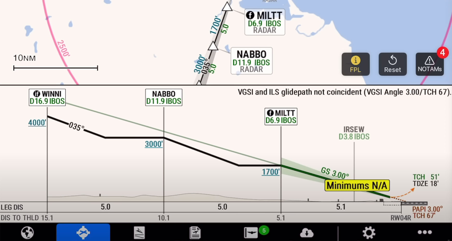
Nine years in the making, Garmin has reinvented digital aeronautical procedural charts with a new product it calls SmartCharts. Available with the Garmin Pilot app for iOS, the SmartCharts procedures automatically adjust and scale as the pilot zooms and pans within the chart, similar to Garmin’s data-driven maps across its entire aviation product line. This data also allows SmartCharts to highlight details and notes that could be easily overlooked and lost on traditional charts, while also reducing clutter—and reducing the potential for error. In a first for the industry, the approach vertical profile view on the approach SmartChart is geo-referenced, with the aircraft appearing on the profile at its altitude.
Additionally, airport surface SmartCharts add additional visual information in color, like airport lighting systems, hold short lines, other airport markings and windsock locations. Airport diagrams also have Quick Access buttons at the top of the chart that showcase airport information like communication frequencies, runway information and alternate minimums data. This design removes the need to memorize traditional airport symbols like non-standard alternate minimums and makes alternate minima details easily accessible. A standout is the Smart Binders feature, which groups the charts by type—approach, departure, arrival or airport info—in the airport tab for easier and faster searching.