Register

ForeFlight Sensor-Based Turbulence Reporting

Using sensors in the ForeFlight Sentry and Sentry Plus ADS-B receivers, the latest Reported Turbulence feature betters forecasted turbulence data.

That’s the nationwide reported turbulence map, lower left, showing live reporting from Sentry ADS-B receivers at 7000 feet. The turbulence information window, lower right, offers useful expanded data, including timestamps and locations.

We’ve all been either pleasantly surprised or severely rattled when the forecasted turbulence reports turn out to be wrong. But ForeFlight has added another tool in the belt with a live automated turbulence reporting utility that gathers recorded data from airborne Sentry portable ADS-B receivers. It’s the latest feature that was rolled out in the ForeFlight Mobile Pro Plus and Performance Plus app subscription plans.
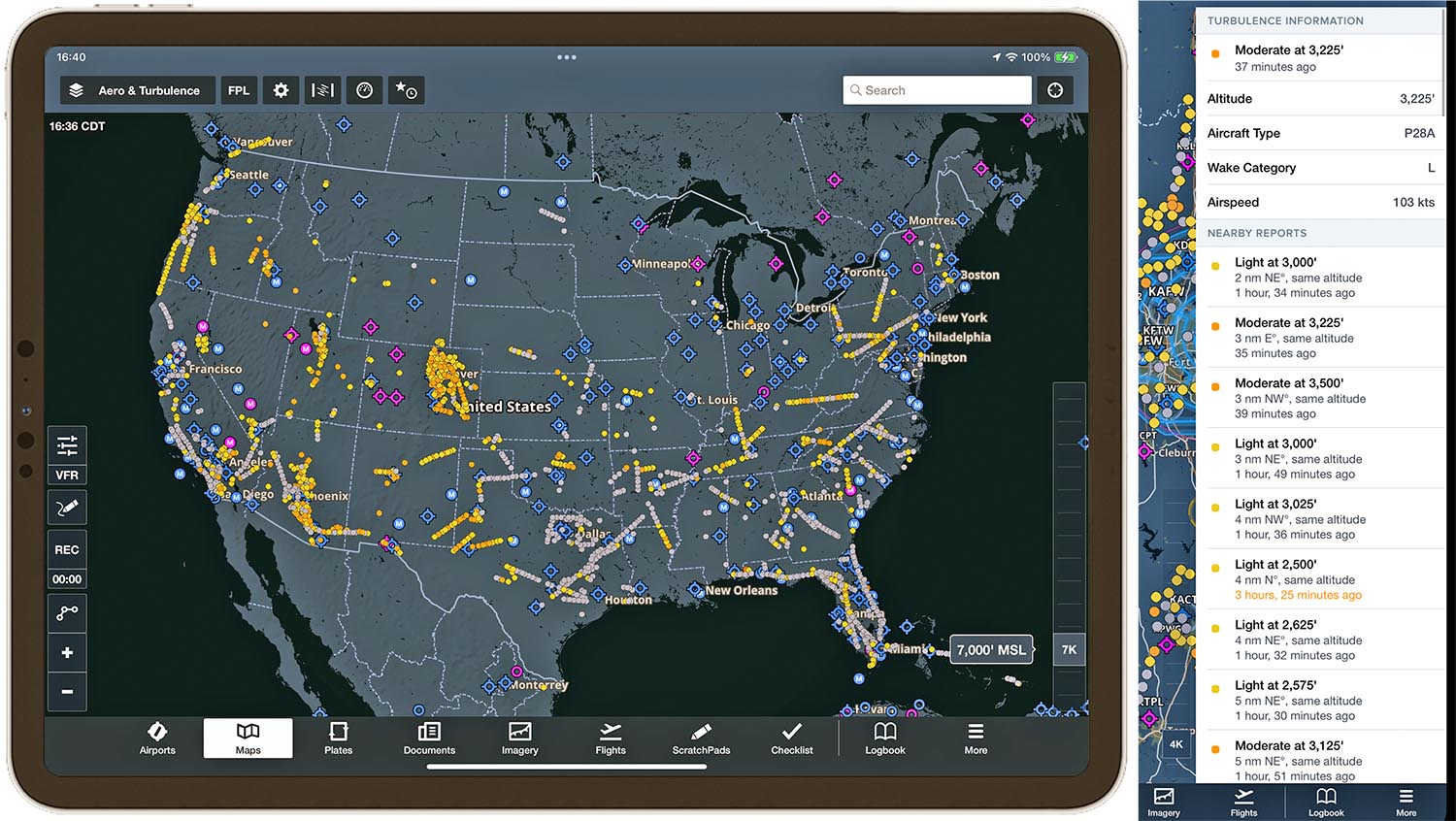
Dots on the map

The Reported Turbulence map layer in the latest version (16.4, April 2024) of ForeFlight Mobile displays the measured intensity of turbulence at multiple altitudes using interactive colored dots on the map. You simply activate the feature from the layer selector.

Larry Anglisano

Editor in Chief Larry Anglisano has been a staple at Aviation Consumer since 1995. An active land, sea and glider pilot, Larry has over 30 years’ experience as an avionics repairman and flight test pilot. He’s the editorial director overseeing sister publications Aviation Safety magazine, IFR magazine and is a regular contributor to KITPLANES magazine with his Avionics Bootcamp column.